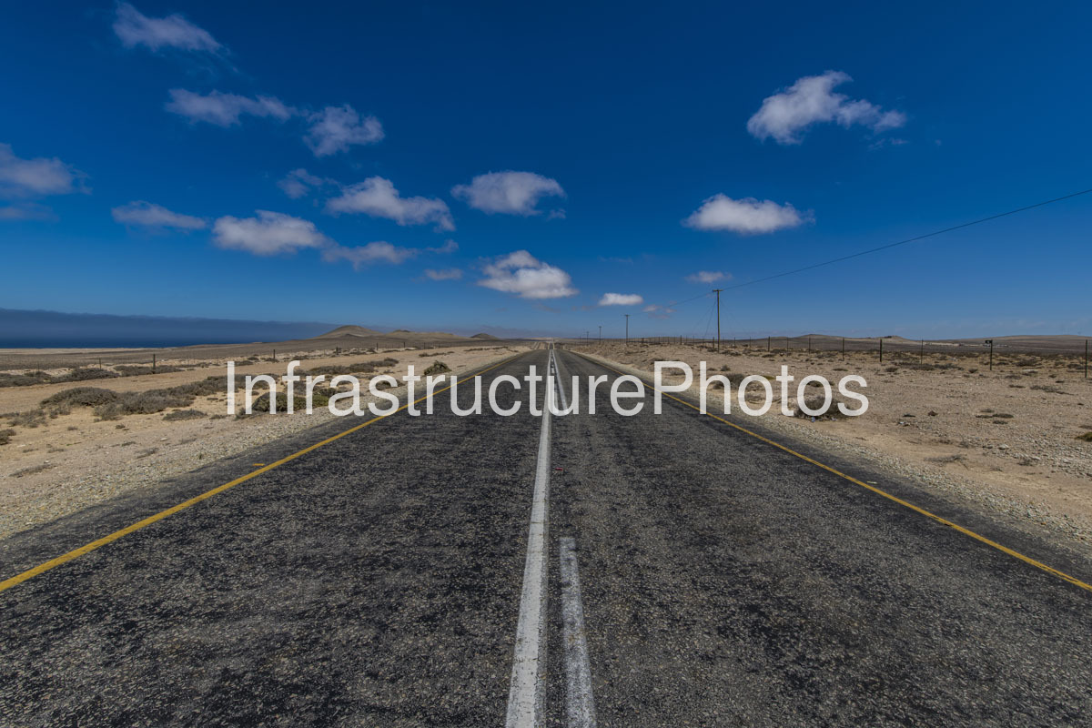
his photograph captures a long, remarkably straight section of paved highway crossing the arid landscape of Namakwa in the Northern Cape, South Africa. The road disappears towards the distant horizon, creating a strong linear perspective across an immense, sparsely populated landscape. Low desert vegetation, rocky ground, simple utility infrastructure and a vast blue sky emphasise the remoteness of the route and the extraordinary scale of the Namaqualand landscape.
The photograph is characteristic of the Namakwa District, one of South Africa’s most expansive and sparsely populated regions. The district occupies the north-western part of the Northern Cape and stretches from the Atlantic Ocean inland towards the country’s border with Namibia. Its landscape varies from the coastal desert and semi-desert environments of the Richtersveld and Namaqualand to more mountainous terrain further south and east.
The road visible here is representative of the major transport infrastructure crossing the region. The N7 National Route is the principal north-south transport corridor through Namakwa, linking Cape Town and the Western Cape with Namibia. Within the district, the N7 passes through or near settlements including Garies, Kamieskroon, Springbok and Steinkopf before continuing towards Vioolsdrift and the Namibian border. The N14 provides the major east-west connection between Springbok and the interior.
The road markings provide several clues to the highway’s classification. The solid yellow lines along both edges are characteristic of South African roads, while the central white markings separate opposing traffic. The exceptionally broad open shoulders and absence of buildings, intersections or roadside commercial development reinforce the remote character of the route.
The surrounding terrain is typical of the Namaqualand semi-desert, with low-growing shrubs and widely scattered vegetation surviving in an environment characterised by low and highly seasonal rainfall. Unlike the heavily vegetated landscapes found elsewhere in the Western Cape, vegetation here is sparse and closely adapted to arid conditions. The exposed soil and gravel create a muted palette of beige, grey and brown beneath the intensely blue sky.
The image also illustrates the importance of roads in connecting isolated communities and economic activities across the Northern Cape. Namakwa has a relatively small population distributed over a very large geographical area, meaning that national and regional roads serve distances that can seem enormous compared with more densely populated parts of South Africa.
The N7 is particularly important as an international freight and tourism corridor. It provides the principal road connection between the Western Cape and Namibia, carrying commercial traffic as well as travellers exploring Namaqualand, the Richtersveld and the Namibian border region. Municipal planning documents identify the N7 as the district’s primary transport spine for freight, tourism and everyday travel.
The road’s long, uninterrupted alignment is particularly effective from a photographic perspective. The centreline begins close to the bottom of the frame and gradually narrows towards a single vanishing point near the horizon. The yellow edge markings create two additional converging lines, visually framing the carriageway and reinforcing the immense distance travelled by this infrastructure through the desert.
A series of simple utility poles runs alongside the road, providing another indication of the infrastructure required to support settlements and economic activity in an otherwise sparsely developed region. Fences on both sides of the road define the transport corridor and surrounding land, while the absence of substantial buildings allows the natural landscape to dominate.
The distant low hills provide just enough variation to prevent the horizon from becoming completely flat. Their rounded profiles rise subtly above the desert plain, while the road continues directly towards them. This combination of an apparently endless highway and distant desert hills is particularly characteristic of travelling through the Northern Cape.
Namakwa’s natural environment is also internationally recognised for its exceptional botanical diversity. The region forms part of the broader Succulent Karoo, one of the world’s major biodiversity hotspots and an area famous for its extraordinary concentration of succulent plants. During the winter and spring flowering season, parts of Namaqualand can be transformed by spectacular displays of wildflowers. Outside the flowering season, however, the landscape can appear as stark and austere as it does in this photograph.
27 MB
Reviews
There are no reviews yet.