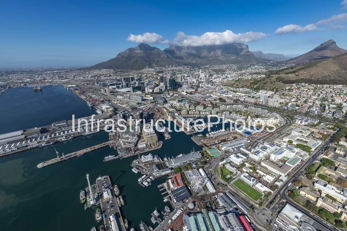
This expansive aerial photograph captures the V&A Waterfront, Cape Town harbour and the city centre beneath the dramatic backdrop of Table Mountain, Lion’s Head and Signal Hill. Taken from above the harbour, the image provides a detailed view of one of South Africa’s most significant waterfront regeneration projects and illustrates how Cape Town’s historic port has evolved into a complex urban district combining maritime infrastructure, retail, hospitality, residential, commercial and cultural uses.
The V&A Waterfront dominates the foreground and middle distance, with its characteristic collection of green-roofed buildings, historic harbour structures, quays and marina basins clearly visible. The precinct was founded in 1988 with the objective of reconnecting Cape Town with the ocean, revitalising the working harbour and creating new economic opportunities. Today, the V&A Waterfront covers approximately 123 hectares and continues to function alongside an active port environment.
The photograph provides an excellent overview of the waterfront’s maritime infrastructure. Alfred Basin, Victoria Basin and the adjoining harbour channels are filled with yachts, service vessels, fishing boats and other marine craft, while larger commercial harbour facilities extend toward the left side of the image. Long quays, breakwaters, harbour walls and docking facilities demonstrate the extensive engineering that allows Cape Town to maintain an operational harbour immediately alongside a major tourism and commercial destination. The V&A Waterfront continues to accommodate fishing operations, fuel supply, dry-dock and yacht-building facilities, a working syncrolift and the Cape Town Cruise Terminal.
Several recognisable waterfront landmarks can be seen throughout the photograph. The Cape Wheel is prominent near the lower centre, forming a distinctive visual landmark within the waterfront entertainment district. The large green-roofed Victoria Wharf complex extends across the lower portion of the precinct, while the historic Clock Tower District and harbour buildings occupy the older sections closer to the port. The image also shows the transition toward the newer commercial and mixed-use developments surrounding the waterfront and Cape Town Foreshore.
Beyond the harbour, the Cape Town CBD rises toward the slopes of Table Mountain. Numerous commercial and office buildings form a dense urban cluster between the waterfront and the mountain, while established residential neighbourhoods climb the lower slopes. The Cape Town International Convention Centre forms part of the Foreshore development and is located close to the waterfront, reinforcing the area’s importance as a major business, tourism and events district.
Table Mountain provides the defining natural element of the composition. Its distinctive flat-topped summit and steep sandstone slopes dominate the background, while Lion’s Head and Signal Hill frame the city from either side. The contrast between the immense natural landscape and the carefully engineered waterfront creates a particularly powerful representation of Cape Town’s geography and urban identity.
Location: V&A Waterfront and Cape Town harbour, Cape Town, Western Cape, South Africa. Architect: Multiple architects, engineers and development teams; no single architect is responsible for the entire V&A Waterfront precinct. Completed: Modern redevelopment commenced in 1988 and continues through successive development phases. Architectural Style: Mixed historic, Victorian-inspired, postmodern and contemporary waterfront architecture. Building Use: Mixed-use waterfront precinct incorporating retail, hospitality, residential, commercial, cultural, leisure and working harbour infrastructure.
36 MB
Reviews
There are no reviews yet.