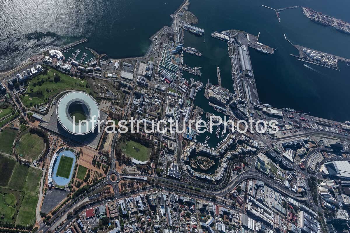
This detailed aerial photograph captures the Green Point and V&A Waterfront precinct of Cape Town, providing a remarkable view of DHL Stadium, Green Point Urban Park, the historic harbour, marinas, commercial development and the extensive infrastructure of the Port of Cape Town. Viewed from above, the image clearly illustrates how sporting infrastructure, waterfront regeneration, working harbour operations, transport networks and dense urban development have been integrated into one of Cape Town’s most important metropolitan areas.
The most prominent structure in the image is DHL Stadium, formerly Cape Town Stadium, which occupies a commanding position between Green Point and the V&A Waterfront. Designed for the 2010 FIFA World Cup, the stadium was completed in 2009 and was designed by GMP Architekten in collaboration with local architects Louis Karol and Point Architects. Its distinctive circular form is particularly impressive from the air, with the large elliptical roof enclosing the seating bowl and playing field. The stadium was designed to seat approximately 68,000 spectators for the World Cup and its lightweight roof structure incorporates translucent materials that allow the building to respond dramatically to changing daylight conditions.
Surrounding DHL Stadium is Green Point Urban Park, an extensive landscaped public space that forms an important component of the precinct. The contrast between the stadium’s highly engineered geometry and the surrounding green landscape is clearly visible in this aerial view. The adjoining athletics facilities, pedestrian spaces, roads and landscaped areas demonstrate how the stadium became part of a broader urban redevelopment rather than functioning as an isolated sporting venue.
Immediately beyond the stadium lies the V&A Waterfront, one of Cape Town’s defining urban developments. The 123-hectare precinct occupies the edge of the city’s historic harbour and combines commercial, residential, retail, hospitality, recreational and cultural uses with an active working port. The Waterfront was established in 1988 with the objective of reconnecting Cape Town with its oceanfront while revitalising the historic harbour. Today, it remains closely integrated with maritime operations, including fishing, commercial shipping, marine services, yacht facilities and cruise activities.
The aerial perspective makes the harbour infrastructure particularly compelling. Long breakwaters, quays, docks, berths, warehouses and marine facilities extend into Table Bay, creating a complex network of water and land infrastructure. The V&A Waterfront’s working harbour contains approximately 3.5 kilometres of quay walls and jetties in regular use, demonstrating that the precinct is much more than a commercial waterfront development.
The photograph also captures the extensive road infrastructure linking Green Point, the Waterfront and Cape Town’s central business district. Curving arterial roads form a strong visual boundary between the stadium precinct and the dense urban neighbourhoods further south, while bridges, ramps and intersections demonstrate the importance of transport connectivity within this rapidly evolving part of the city.
19 MB
Reviews
There are no reviews yet.