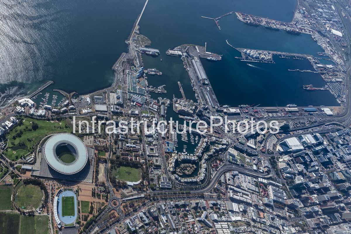
This striking aerial photograph presents a detailed bird’s-eye view of Cape Town’s Green Point precinct, with the DHL Stadium prominently positioned beside the V&A Waterfront, the Port of Cape Town and the Atlantic Ocean. The image captures an exceptional concentration of sporting, commercial, residential, recreational and maritime infrastructure within one of South Africa’s most significant urban environments. From above, the relationship between the stadium, historic harbour, modern waterfront development and surrounding road network becomes particularly clear.
The dominant landmark in the lower-left of the photograph is the DHL Stadium, formerly known as Cape Town Stadium. The stadium was constructed between 2007 and 2009 as a major component of Cape Town’s preparations for the 2010 FIFA World Cup. Its distinctive circular form, sweeping roof and translucent outer envelope were designed to create a visually lightweight structure that responds to the surrounding landscape. The architectural design was led by GMP Architekten of Germany in association with Louis Karol and Point Architects in Cape Town. Construction was completed in 2009.
The stadium’s architecture is particularly effective when viewed from the air. Its elliptical bowl and expansive roof form create a strong geometric contrast with the surrounding Green Point Urban Park and the dense city grid. The roof incorporates a sophisticated combination of steel, cables, glass and translucent membrane, with the structure designed to respond to Cape Town’s strong winds and climatic conditions. The stadium was originally configured for approximately 68,000 spectators during the 2010 FIFA World Cup.
Immediately surrounding the stadium is the extensive Green Point precinct, including landscaped open space and the adjacent athletics facilities. The aerial viewpoint illustrates how the stadium was incorporated into a much larger urban intervention rather than being treated as an isolated sporting venue. Roads, pedestrian routes, landscaped areas and public spaces connect the stadium with the surrounding neighbourhood and the V&A Waterfront.
To the north and east of the stadium, the photograph reveals the extensive V&A Waterfront and Port of Cape Town. The Waterfront has evolved from Cape Town’s historic working harbour into a large mixed-use neighbourhood while retaining active maritime operations. Today, the 123-hectare precinct combines offices, residential buildings, hotels, retail, tourism, cultural facilities, marinas and working harbour infrastructure. The V&A Waterfront was founded in 1988 with the objective of reconnecting Cape Town with its oceanfront and revitalising the historic harbour.
The harbour dominates the upper portion of the image, with breakwaters, quays, berths, warehouses, marine facilities and access roads forming a complex piece of coastal infrastructure. The contrast between the large working harbour and the carefully planned public spaces and commercial development of the V&A Waterfront is particularly visible from this altitude. The area remains a working maritime environment, accommodating fishing vessels, commercial vessels, yachts, cruise operations and other marine activities.
21 MB
Reviews
There are no reviews yet.