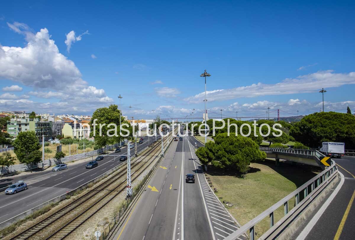
This photograph captures the northern approach to the 25 de Abril Bridge (Ponte 25 de Abril) in Alcântara, Lisbon, presenting one of the Portuguese capital’s most important transport landscapes. Rather than focusing solely on the bridge itself, the image shows the complex relationship between road infrastructure, railway infrastructure, elevated interchanges, landscaped public space and the dense urban fabric of western Lisbon. The red suspension structure of the bridge appears in the distance, while the railway tracks and multilane roadways lead the eye towards the Tagus crossing, creating a strong sense of movement and connectivity through the scene.
The location is closely associated with the Avenida da Índia and Avenida de Ceuta transport corridors in Alcântara, where several major routes converge before reaching the bridge. The railway alignment visible in the centre of the photograph forms part of the Linha do Sul, the railway route that crosses the 25 de Abril Bridge and continues south towards Almada and beyond. The northern railway approach is particularly significant because the bridge was originally designed with provision for future rail traffic, although the railway deck was only completed decades after the road crossing opened. The railway connection officially entered service on 29 July 1999, creating a direct rail connection between Lisbon and the southern bank of the Tagus.
The 25 de Abril Bridge itself is one of Portugal’s most significant works of twentieth-century engineering. Construction began in November 1962 following the award of the project to a consortium led by United States Steel International, with the suspension bridge designed by the New York engineering office Steinman, Boynton, Gronquist & London, working with Portugal’s Gabinete da Ponte sobre o Tejo and the Laboratório Nacional de Engenharia Civil. The bridge was opened to road traffic on 6 August 1966, originally carrying the name Ponte Salazar. Following the Portuguese Revolution of 25 April 1974, it was renamed the Ponte 25 de Abril.
The bridge was conceived from the beginning with the possibility of carrying both road and rail traffic. The original structure therefore incorporated provisions for the later installation of a railway deck. Between the mid-1990s and 1999, the bridge underwent major structural reinforcement and modification, including the widening of the road deck to six lanes and installation of the lower railway deck. This transformation turned the bridge into a critical roadover-rail transport link, integrating Lisbon more closely with the rapidly developing communities on the south bank of the Tagus.
The scale of the infrastructure is evident even from this distant viewpoint. The bridge has a central span of approximately 1,013 metres and a total length of around 2.3 kilometres, while its main towers rise approximately 190 metres above the water. The northern approach includes a substantial concrete viaduct, while the wider road system distributes traffic between the bridge, Alcântara and Lisbon’s surrounding arterial network. Infraestruturas de Portugal describes the bridge as having the largest central span in Europe among bridges combining road and rail traffic.
The railway infrastructure in this photograph is particularly important visually. The parallel tracks form a powerful linear element through the centre of the composition, accompanied by overhead electrical equipment and structural gantries. On either side, multilane roadways accommodate conventional vehicular traffic. The result is a remarkably clear illustration of multimodal transport infrastructure, where rail and road have been integrated into a single metropolitan corridor. The image therefore documents more than a famous bridge; it records the systems required to make a major metropolitan connection function.
The elevated roadway on the right adds another layer of complexity. Its sweeping geometry, guardrails and directional signage contrast with the straight railway alignment below, while the large landscaped traffic island provides a visual break between the infrastructure elements. The mature umbrella-shaped pine trees are characteristic of the landscaped character of Lisbon’s western districts and help soften the otherwise highly engineered environment.
The distant 25 de Abril Bridge provides the defining focal point. Its distinctive red-painted steel structure stands out against the blue sky and surrounding landscape, while the elevated viewpoint allows the viewer to understand how the bridge approaches are embedded within the city. The photograph is especially effective because the bridge is not presented as an isolated monument: it is shown as part of a functioning transport system carrying people and goods between the two banks of the Tagus.
Today, the bridge remains fundamental to Lisbon’s metropolitan mobility. Infraestruturas de Portugal reports that roughly 300,000 users cross the bridge daily by road and rail, illustrating the continuing importance of an infrastructure project that began construction more than six decades ago.
22 MB
Reviews
There are no reviews yet.