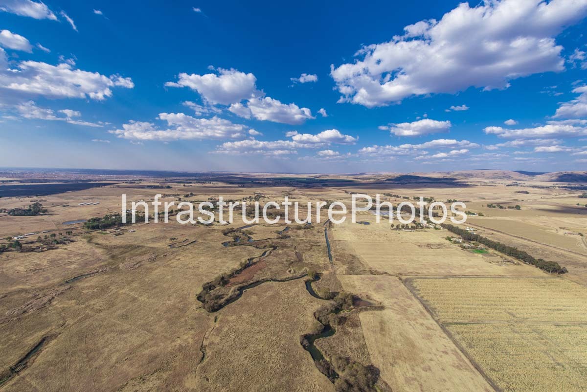
This aerial photograph captures an expansive South African Highveld agricultural landscape, where cultivated farmland, natural grassland, wetlands and a meandering river create a broad rural landscape extending towards distant hills. The elevated perspective reveals the relationship between the river system and surrounding agricultural land, with large fields, scattered farmsteads, tree-lined drainage channels and open grassland forming a distinctive Highveld rural environment.
The landscape is characterised by its wide horizon and gently undulating terrain. A narrow river or natural watercourse winds through the centre of the photograph, forming a strong visual line through the otherwise expansive agricultural landscape. In several areas, the watercourse broadens into small pools and wetland features, while dense vegetation follows sections of the riverbank. These wetter areas provide a noticeable contrast with the surrounding dry winter grassland and harvested or dormant agricultural fields.
The photograph was taken from the air, providing a perspective that clearly illustrates the scale and pattern of agricultural land use. Large fields occupy much of the landscape, their boundaries forming geometric shapes across the naturally irregular terrain. The contrast between cultivated fields and uncultivated grassland is particularly evident, demonstrating how agricultural activity has been integrated into the broader natural landscape.
The dry, golden-brown vegetation is characteristic of the Highveld during the winter months, when grasses become dormant and the landscape takes on a predominantly ochre and straw-coloured appearance. Patches of greener vegetation remain concentrated around the river, drainage channels, cultivated areas and clusters of trees, highlighting the importance of water availability within the otherwise dry landscape.
Scattered farmsteads and rural properties can be seen throughout the middle distance. Groups of mature trees surround many of these properties, creating small green islands within the extensive agricultural landscape. Farm buildings, access tracks, irrigation features and cultivated plots provide evidence of a working rural environment, while the relatively low density of development preserves the expansive character of the landscape.
One of the most distinctive elements in the photograph is the meandering river system in the foreground and middle distance. Its irregular course contrasts strongly with the straight boundaries of the agricultural fields. The watercourse appears to have created a network of wetter depressions and channels across the surrounding grassland, with riparian vegetation following its course. These natural drainage patterns are an important component of the Highveld landscape and provide ecological corridors through predominantly agricultural areas.
The aerial viewpoint also reveals several smaller ponds and water features distributed across the farmland. These may serve agricultural or livestock purposes, while some appear to form naturally within low-lying areas. Together with the river, they demonstrate the way water is distributed across the gently undulating terrain.
Beyond the agricultural fields, the landscape rises gradually towards a series of low, rounded hills and ridges on the horizon. These geological and topographical features provide a strong sense of depth and scale. The distant hills are softened by atmospheric perspective, contrasting with the detailed textures of the fields and river vegetation in the foreground.
The expansive sky occupies a substantial portion of the composition and contributes strongly to the sense of openness. A series of large white cumulus clouds stretches across the deep blue sky, creating a dramatic contrast with the dry winter landscape below. The cloud formations also emphasise the considerable scale of the rural environment, with the horizon extending almost uninterrupted across the width of the photograph.
The image provides a valuable aerial record of the relationship between agriculture, water and natural vegetationwithin South Africa’s Highveld region. The geometric organisation of the cultivated land is balanced by the irregular patterns of the river, wetlands, tree belts and natural grassland. This combination creates a landscape in which human agricultural activity and natural systems remain clearly visible from above.
The photograph is particularly suitable for illustrating rural South African landscapes, agricultural land use, environmental geography, water resources, farming regions and Highveld scenery. The aerial perspective makes it possible to appreciate patterns that are difficult to see from ground level, including the extent of individual fields, the course of the river and the distribution of farmsteads and vegetation.
The combination of expansive farmland, golden winter grass, winding watercourses, scattered trees and distant hills gives the landscape a strong sense of place. Rather than focusing on a single structure or landmark, the photograph documents the broader character of a working agricultural environment and the relationship between its natural and human elements.
20.8 MB
Reviews
There are no reviews yet.