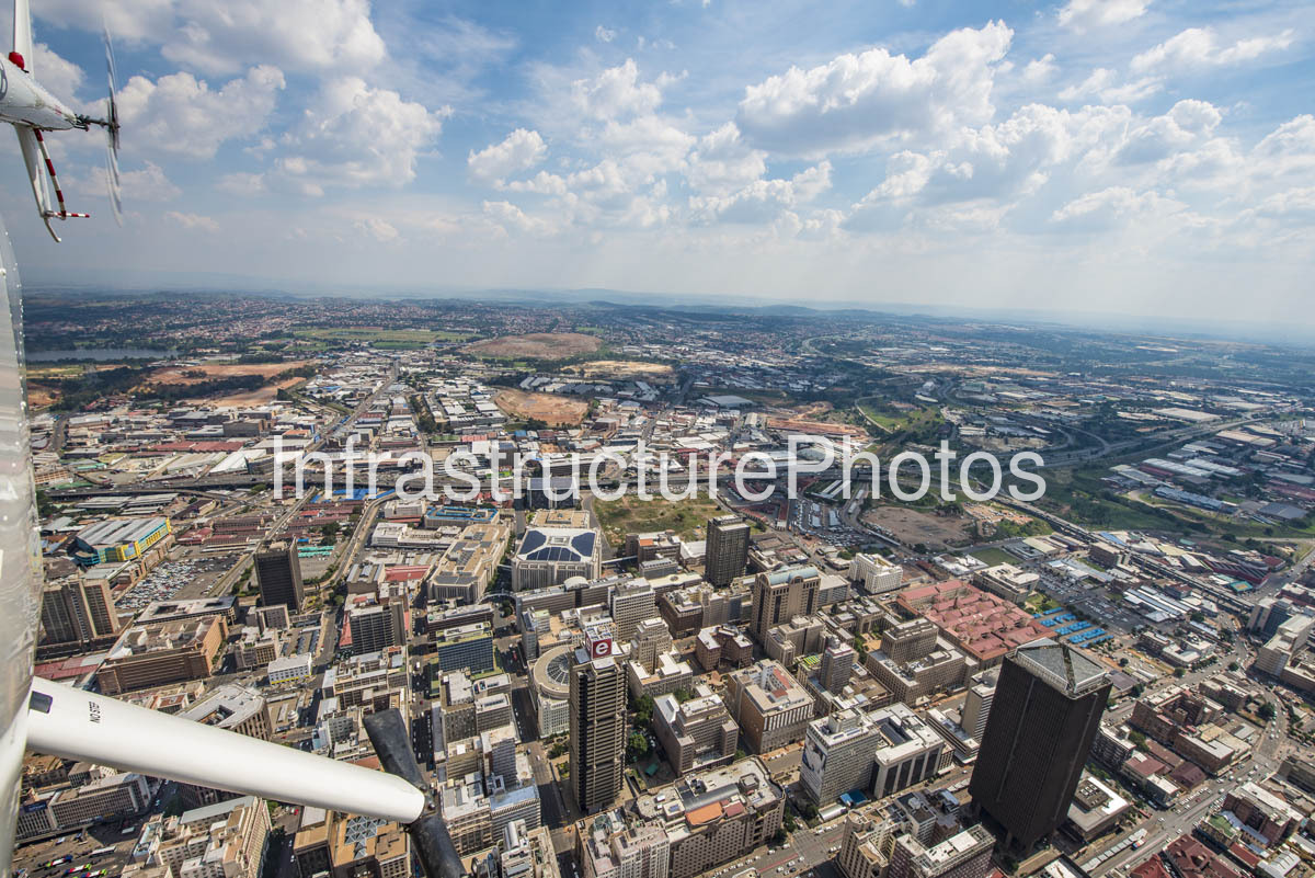
This aerial photograph presents a sweeping oblique view across the Johannesburg Central Business District and the surrounding inner-city landscape, capturing the extraordinary density, scale and complexity of South Africa’s largest urban commercial centre. Photographed from the air, the image looks across a tightly packed collection of office buildings, commercial properties, transport infrastructure, industrial areas, residential neighbourhoods, open land and major road corridors, revealing how Johannesburg’s historic city centre transitions into the broader metropolitan landscape.
Location: Johannesburg Central Business District, City of Johannesburg, Gauteng, South Africa. The Johannesburg CBD forms the historic and commercial heart of the city and remains an important concentration of offices, retail, government activity, transport infrastructure and urban redevelopment. Johannesburg’s inner city encompasses a number of interconnected districts, including the CBD, Newtown, Marshalltown, Doornfontein and surrounding areas. Joburg Tourism describes the CBD as a combination of heritage, commercial activity and ongoing urban renewal, with major landmarks including the Carlton Centre and Main Street.
Architect: Not applicable – aerial cityscape photograph documenting multiple buildings, infrastructure systems and urban districts rather than a single architectural work.
Completed: Not applicable – the image documents an evolving urban environment containing buildings and infrastructure constructed across multiple periods.
Architectural Style: Mixed urban architecture, incorporating Modernist, International Style, Art Deco, Victorian, Edwardian and contemporary commercial architecture.
Building Use: Mixed-use urban environment comprising commercial offices, retail, industrial and light-industrial properties, residential neighbourhoods, public infrastructure, transport facilities and civic functions.
From this elevated viewpoint, Johannesburg’s characteristic urban structure becomes particularly clear. The foreground is dominated by the dense blocks of the CBD, where buildings occupy much of the available urban land and streets form a highly ordered network of corridors through the city. Beyond this central concentration, the urban fabric becomes increasingly dispersed, transitioning into industrial properties, transport infrastructure, residential neighbourhoods, open spaces and peripheral development.
One of the most compelling aspects of the photograph is the way it illustrates the relationship between Johannesburg’s historic commercial core and its wider metropolitan infrastructure. Major roads and highway interchanges are visible cutting through the landscape, connecting the CBD with surrounding districts and the city’s broader road network. These transport corridors are an essential component of Johannesburg’s economic geography, supporting the movement of commuters, freight and commercial activity across the metropolitan area.
The image also demonstrates the extraordinary diversity of Johannesburg’s built environment. Closely packed high-rise office buildings stand alongside much lower commercial structures, warehouses, parking areas and industrial facilities. This mixture reflects more than a century of urban development, redevelopment and changing economic activity. Johannesburg’s architectural character is consequently not defined by a single style but by successive layers of construction.
The city’s CBD contains several important architectural periods, including Victorian and Edwardian buildings, Art Deco structures and Modernist commercial towers. The latter became particularly prominent during Johannesburg’s rapid economic expansion in the mid-twentieth century. The city’s skyline continues to be strongly associated with these high-rise commercial developments, including the Carlton Centre, which rises 223 metres and contains 50 floors. The building was developed from the late 1960s and officially opened in 1973, becoming one of Johannesburg’s defining architectural landmarks.
The Carlton Centre is especially significant within the story of Johannesburg’s skyline. Designed by Skidmore, Owings & Merrill with Rhodes-Harrison Hoffe and Partners, the complex was conceived as a major mixed-use development incorporating offices, retail, hospitality and public spaces. Its development reflected the confidence and economic ambition of Johannesburg during the second half of the twentieth century.
Beyond the CBD itself, the photograph reveals how rapidly the city’s urban density changes. Large areas of industrial and commercial development spread across the middle distance, characterised by expansive roof structures and extensive paved surfaces. These areas contrast sharply with the compact verticality of the CBD and demonstrate the different land-use requirements of a major metropolitan economy.
Transport infrastructure is another defining feature of the image. Roads, bridges, ramps and interchanges create large geometric patterns across the landscape. From ground level, these systems can appear fragmented and difficult to understand, but the aerial perspective reveals their interconnected nature. Major arterial routes converge, separate and reconnect around commercial and industrial districts, creating a complex infrastructure network supporting Johannesburg’s daily movement of people and goods.
23 MB
Reviews
There are no reviews yet.