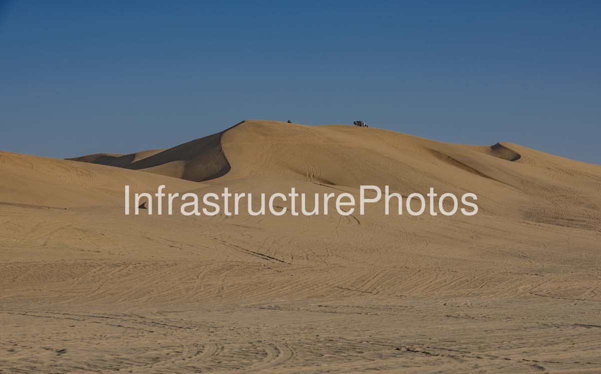
This photograph captures the expansive sand dunes of Dorob National Park on Namibia’s central Atlantic coast, presenting the stark beauty of the Namib Desert in one of the country’s most distinctive protected landscapes. The image focuses on a broad, wind-shaped dune rising above an open field of fine desert sand, with numerous tracks etched across its slopes and foreground. The absence of buildings, vegetation and other substantial structures emphasises the scale and isolation of the landscape, while the smooth contours of the dunes demonstrate the continual influence of wind on the Namibian coastal environment. The photograph was taken in March 2018 and provides a strong visual record of the dune belt within the Dorob National Park.
Dorob National Park was proclaimed in 2010 and covers approximately 7,800 square kilometres along the central Namibian coast. It extends between the Ugab River and the Skeleton Coast National Park to the north and the southern Namib-Naukluft landscape, incorporating a varied combination of Atlantic coastline, sandy beaches, coastal dunes, gravel plains and desert habitats. The park includes areas around Swakopmund, Henties Bay and Wlotzkasbaken, while the Omaruru River crosses the protected area and the Swakop River lies immediately south of its boundary. The Namibian Ministry of Environment, Forestry and Tourism identifies the park’s natural features as including sandy beaches with dune hummocks, extensive gravel plains and extensive lichen fields.
The dunes represented in the photograph are part of a broader coastal desert system shaped by the interaction of wind, sand and the cold Atlantic Ocean. The Namib Desert is exceptionally arid, and the central coastal region around Swakopmund and Walvis Bay receives very little rainfall. Instead, moisture from coastal fog and marine air plays an important ecological role. This creates a landscape that can appear almost completely barren while supporting highly specialised plants and animals adapted to extreme desert conditions.
The Ministry of Environment, Forestry and Tourism lists the Dorob National Park’s vegetation as part of the Namib Desert biome and identifies species including pencil bush, dollar bush, shepherd’s tree and Welwitschia mirabilis. Lichens are particularly significant within the park, with extensive lichen fields occurring in areas north of Wlotzkasbaken and Cape Cross. These organisms are extremely sensitive to disturbance, making the management of vehicle movement across the desert environment an important conservation consideration.
The photograph itself illustrates the powerful physical processes that shape this environment. The main dune has a broad, gently rising windward surface and steeper sculpted sections where sand has accumulated and subsequently been redistributed by prevailing winds. The smooth crest and sweeping ridges are interrupted by numerous tyre tracks, indicating recreational vehicle activity across the dune landscape. Such tracks are characteristic of parts of Namibia’s coastal dune belt, where off-road driving, dune recreation and tourism have become important visitor activities but also require careful management to minimise environmental damage.
The southern part of Dorob National Park includes the well-known Dune 7 area near Walvis Bay. Dune 7 is identified by Namibia’s Ministry of Environment, Forestry and Tourism as the highest peak in the park and is a popular recreational destination for activities including hiking, dune boarding and other non-motorised dune-based activities. The Ministry has also developed concession processes for tourism facilities and recreational activities in the Dune 7 area, illustrating the continuing importance of balancing tourism access with conservation of the fragile desert environment.
Dorob’s location between the Atlantic Ocean and the interior Namib Desert creates a landscape of exceptional contrasts. Coastal fog can roll inland from the cold Benguela Current, while the dunes themselves can experience intense sunlight, strong winds and extreme dryness. The result is an environment in which apparently simple features such as a dune ridge or gravel plain can support complex ecological relationships. The park’s coastal position also contributes to its importance for wildlife, particularly birds and marine species. The Ministry records species including springbok, oryx, Cape fur seal, brown hyena and zebra, as well as a substantial bird population that includes the Damara tern, Ludwig’s bustard, Rüppell’s korhaan, African black oystercatcher and Gray’s lark.
The wider protected area also contains important geological, archaeological and cultural features. The Messum Crater in the northern part of Dorob contains San rock paintings and archaeological sites associated with earlier Damara communities. These features demonstrate that the apparently empty desert landscape has a long human history and has supported human movement and occupation despite its harsh environmental conditions.
The name “Dorob” is associated with the idea of dry land, an appropriate description for a landscape in which exposed sand and gravel dominate the environment. The park forms an important part of Namibia’s coastal conservation network, linking with the Skeleton Coast Park to the north and lying adjacent to the southern Namib-Naukluft conservation landscape. Together these protected areas create an extensive conservation corridor along the Namibian Atlantic coast.
This photograph is particularly effective because of its minimalist composition. The dune occupies the majority of the frame, while the deep blue sky provides an almost uninterrupted background. The subtle variations in the sand’s colour and texture reveal the changing angle of the dune surface, while the network of tracks provides scale and evidence of human interaction with the landscape. Small figures or objects visible along the crest further emphasise the considerable size of the dune.
The image also documents the tension between natural desert processes and recreational use. The tyre tracks crossing the sand show how accessible parts of Dorob’s dune environment have become to visitors, while the apparently fragile surface demonstrates why responsible access and designated routes are important. In 2026, Namibia’s Ministry of Environment, Forestry and Tourism was again consulting on off-road concessions within the Dorob National Park dune belt, highlighting the continuing need to manage recreational vehicle access and tourism development within this sensitive coastal environment.
Location: Dorob National Park, Erongo Region, central Atlantic coast of Namibia. The park extends along the Namibian coastline between the Ugab River and the Skeleton Coast Park to the north and the Namib-Naukluft landscape to the south.
20.8 MB
Reviews
There are no reviews yet.