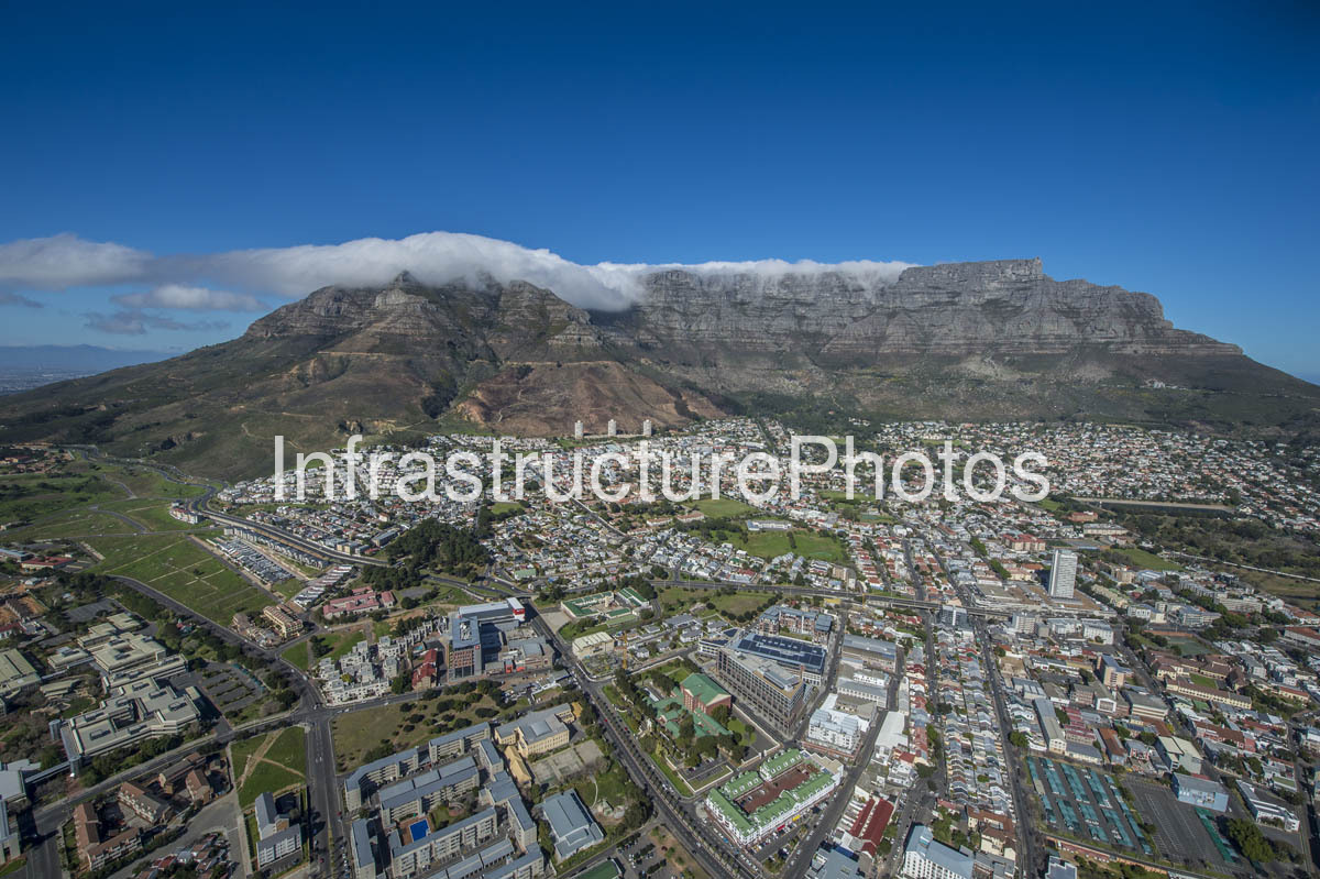
This panoramic aerial photograph captures the historic District Six area of Cape Town, with the distinctive slopes and sheer sandstone cliffs of Table Mountain dominating the skyline behind the city. The image looks across the dense urban landscape from the southern and eastern edge of the central city, revealing the remarkable relationship between Cape Town’s historic inner-city neighbourhoods, modern commercial development, transport infrastructure and the natural amphitheatre created by Table Mountain. The broad mountain face, partly covered by its characteristic cloud “tablecloth”, forms an imposing backdrop to one of the most historically significant urban landscapes in South Africa.
The area visible in the foreground and middle ground is associated with the historic District Six, today incorporating the area officially known as Zonnebloem as well as adjoining parts of the Cape Town city bowl. District Six developed as a diverse, densely populated inner-city community close to the centre of Cape Town. Its location between the city centre and the slopes of Devil’s Peak made it an important residential area for working-class communities, merchants, artisans, labourers and immigrants. The name District Six originated from Cape Town’s municipal division into six districts in 1867.
The history of the area is inseparable from the forced removals carried out under apartheid. On 11 February 1966, District Six was declared a white area under the Group Areas Act. Over the following years, more than 60,000 residents were forcibly removed, primarily to newly developed settlements on the Cape Flats, while homes, businesses and much of the historic urban fabric were demolished. By 1982, the established community had effectively been destroyed. The clearances radically transformed the physical landscape, leaving large areas vacant and erasing much of the original street pattern and built environment.
In 1970 the area was officially renamed Zonnebloem, referencing the historic Zonnebloem farm on which part of the settlement had developed. The renaming became associated with the attempt to sever the area from its District Six identity. In 2019, the Western Cape Government supported an application to restore the historic name, following a public participation process led by the District Six Museum. The official geographical name was subsequently changed back to District Six.
The aerial perspective makes the physical consequences of this history particularly apparent. While large sections of the original neighbourhood were demolished, surviving residential areas and historic buildings remain interspersed with modern institutional, commercial and residential development. The Cape Peninsula University of Technology’s District Six Campus occupies a substantial portion of the area, while newer buildings and infrastructure have introduced a very different architectural character. At the same time, undeveloped parcels and open spaces remain important reminders of the former neighbourhood and its disrupted urban fabric.
Dominating the entire composition is Table Mountain, one of Cape Town’s most recognisable natural landmarks. Its distinctive flat-topped summit, horizontal sandstone strata and steep slopes rise directly behind the city, creating a dramatic transition from dense urban development to protected mountain landscape. Table Mountain forms part of Table Mountain National Park, which extends along much of the Cape Peninsula and encompasses a remarkable range of natural and cultural landscapes. SANParks describes the mountain as a defining backdrop to cosmopolitan Cape Town and notes its significance within the Cape Floral Kingdom.
The cloud formation visible along the summit is the famous Table Mountain “tablecloth”, created when moist south-easterly air rises against the mountain and forms a blanket of cloud across the plateau. The phenomenon is one of the mountain’s most recognisable visual characteristics and adds considerable drama to this aerial composition. The combination of the cloud-covered summit, exposed sandstone cliffs and densely developed city below demonstrates the extraordinary natural setting in which Cape Town has developed.
The foreground also illustrates Cape Town’s continuing urban transformation. Contemporary office and residential buildings occupy portions of the former District Six landscape, while major roads connect the inner city with Woodstock, Observatory, Salt River, the Cape Town CBD and the southern suburbs. The concentration of newer buildings contrasts with surviving low-rise residential areas and mature vegetation, creating a layered cityscape in which different periods of Cape Town’s history are visible simultaneously.
Reviews
There are no reviews yet.