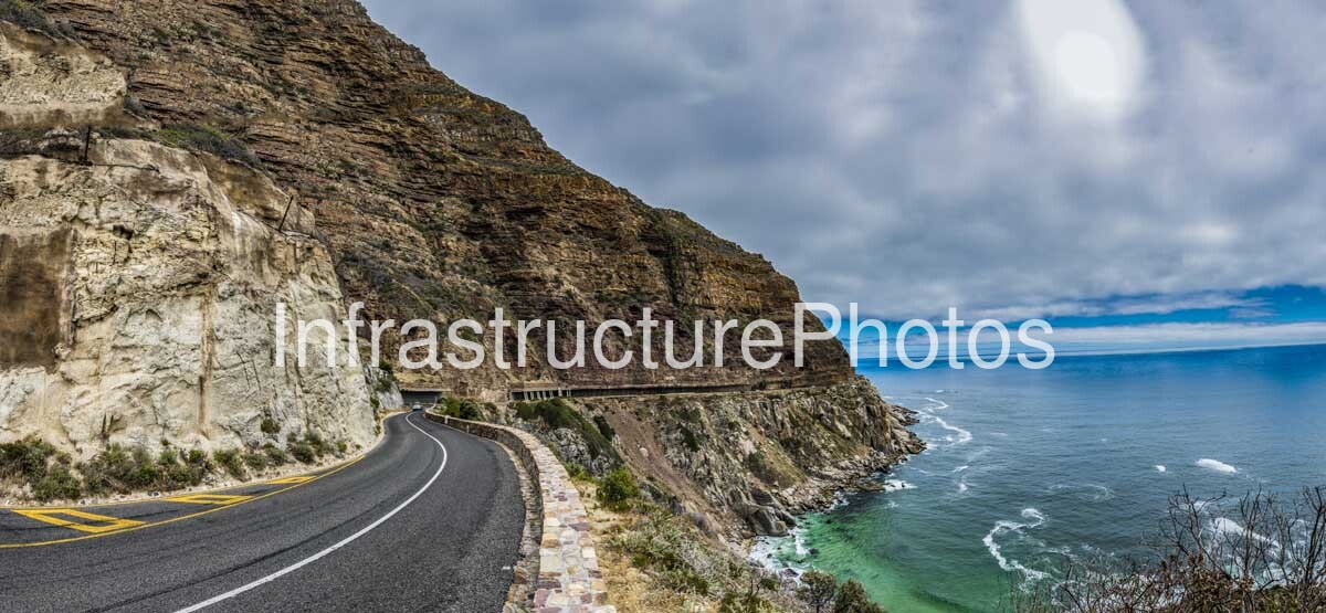
This photograph captures a dramatic section of Chapman’s Peak Drive on the Atlantic coast of the Cape Peninsula, with the road carved directly into the steep mountainside above the ocean. The image highlights the remarkable relationship between civil engineering and the natural landscape: a carefully engineered two-lane road follows the contours of the mountain while the rugged rock face rises immediately to the left and the Atlantic Ocean stretches into the distance on the right. The combination of exposed geological strata, engineered retaining walls, immaculate road surfacing and the intensely blue ocean makes Chapman’s Peak Drive one of South Africa’s most recognisable transport landscapes.
Known affectionately as “Chappies”, Chapman’s Peak Drive is a 9 km toll road connecting Hout Bay with Noordhoek on the western side of the Cape Peninsula. The route winds around the lower slopes of Chapman’s Peak, with 114 curves following the exceptionally steep coastal terrain. Some sections rise to approximately 593 metres above sea level, producing spectacular views over the Atlantic Ocean and the surrounding Cape Peninsula. The official Chapman’s Peak Drive organisation describes the road as one of the world’s most scenic drives and highlights its importance as a transport connection between Cape Town and the South Peninsula.
The road is an outstanding example of early twentieth-century mountain-road engineering. Construction began in 1915, and after several years of difficult work the completed road was officially opened by Prince Arthur of Connaught and Strathearn, then Governor-General of the Union of South Africa. South African Tourism records the construction date from a historical plaque located along the route, while other official tourism material records the road as having opened to traffic in 1922.
The original construction required engineers and workers to cut a narrow route into the almost vertical sandstone and granite slopes of Chapman’s Peak. The photograph illustrates the fundamental challenge of that undertaking: there is very little naturally level ground between the mountain and the sea. The road therefore follows the contours of the rock face, with retaining structures and carefully constructed edges protecting the carriageway from the steep drop towards the Atlantic.
The exposed rock face dominates the left side of the photograph and provides a fascinating geological backdrop to the road. Distinct horizontal layers are clearly visible through the mountain, demonstrating the sedimentary character of parts of the Cape Peninsula’s geology. Weathering has produced irregular faces, ledges and fractured surfaces, while vegetation occupies some of the more stable areas. The road effectively becomes a narrow horizontal incision through this much larger geological formation.
One of the most distinctive elements in the photograph is the stone-faced retaining wall along the seaward edge of the road. Its carefully constructed masonry contrasts with the rugged natural rock above it and provides both a visual and functional boundary between the roadway and the steep coastal slope. The wall also contributes to the characteristic appearance of Chapman’s Peak Drive, where extensive civil engineering has been integrated into an exceptionally dramatic natural setting.
41 MB
Reviews
There are no reviews yet.