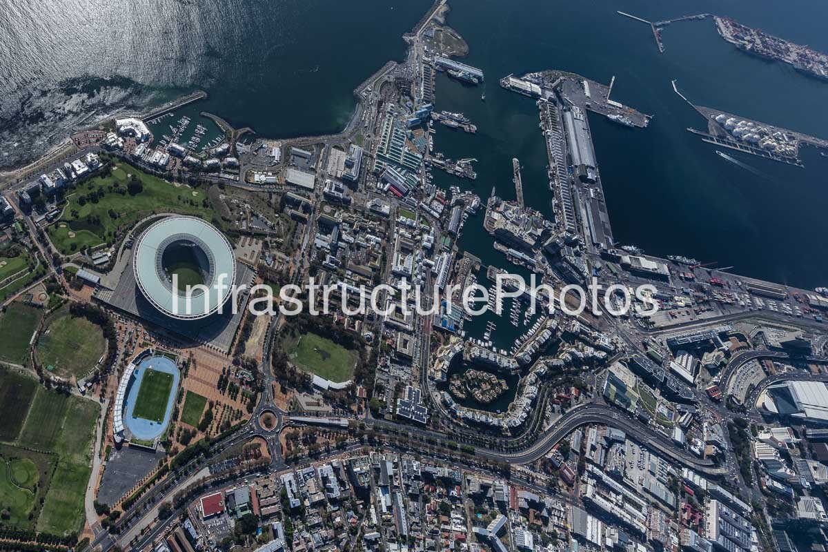
This expansive aerial photograph captures the heart of Cape Town’s V&A Waterfront and harbour, revealing the extraordinary relationship between the city, its working port, the Atlantic Ocean and the slopes of Table Mountain. From this elevated perspective, the photograph documents a highly complex urban environment in which historic maritime infrastructure, contemporary commercial architecture, tourism facilities, residential development and major transport connections converge around one of South Africa’s most recognisable waterfronts.
The V&A Waterfront occupies much of the foreground and right-hand side of the image, with its distinctive collection of green-roofed buildings, quays, marinas and pedestrian-oriented public spaces clearly visible. The photograph provides a particularly strong overview of the precinct’s relationship with the harbour. The V&A Waterfront has its origins in Cape Town’s historic working harbour, with the first major harbour basin constructed in 1860. The modern mixed-use precinct was established in 1988 with the objective of reconnecting the city with the ocean while revitalising the working harbour and creating new economic opportunities. Today, the 123-hectare neighbourhood combines retail, hospitality, residential, commercial, cultural and leisure uses with an active maritime environment.
The central portion of the photograph reveals the extensive network of harbour basins and quays. Victoria Basin and Alfred Basin form important parts of the historic waterfront, while larger port infrastructure extends toward the west and north. Numerous vessels can be seen throughout the harbour, illustrating that this remains an operational maritime environment rather than simply a recreational waterfront. Fishing vessels, commercial ships, yachts, service craft and other marine operations form part of the everyday activity of the precinct. The V&A Waterfront also incorporates dry-dock, yacht-building, fishing and other maritime facilities, reinforcing Cape Town’s long-standing role as a major port city.
Several important waterfront landmarks and districts can be recognised in the image. The green-roofed Victoria Wharf complex occupies the lower-right portion of the photograph and has been trading since 1992. Further into the harbour environment are the Clock Tower and Clock Tower District, positioned at the entrance to the Alfred Basin. The historic Clock Tower dates from 1882 and remains one of the defining heritage landmarks of the waterfront.
40 MB
Reviews
There are no reviews yet.