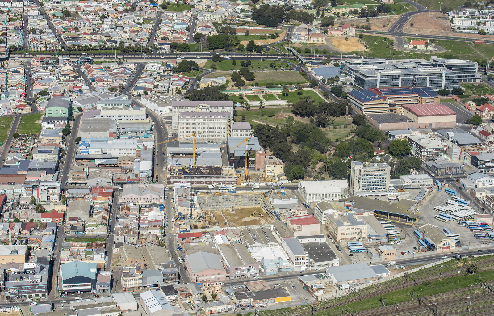
This aerial photograph captures Woodstock Quarter in Woodstock, Cape Town, together with the surrounding commercial, industrial, residential, institutional and transport infrastructure that defines one of Cape Town’s most rapidly changing inner-city neighbourhoods. Located on Sir Lowry Road at the gateway to Woodstock, Woodstock Quarter is a prominent mixed-use development within an established urban area that has undergone significant regeneration and redevelopment.
The focal development in the centre of the image is Woodstock Quarter, a substantial contemporary mixed-use project comprising residential apartments, commercial space and ground-floor retail. The development is located at 187 Sir Lowry Road, Woodstock, and occupies a consolidated city-block site. It was designed by Design Lab, with the development undertaken by Swish Property Group. Woodstock Quarter was completed in 2019.
Woodstock Quarter incorporates approximately 386 apartments, more than 4,000 square metres of A-grade office space and a retail component at ground level. The development combines studios and one- and two-bedroom apartments with commercial and retail uses, creating a vertically integrated urban environment within an established inner-city neighbourhood.
The aerial perspective provides a particularly useful view of how Woodstock Quarter fits into the much larger urban fabric of Woodstock. The development is surrounded by a mixture of older industrial and commercial buildings, warehouses, small businesses, established residential areas and newer multi-storey developments. This juxtaposition of historic low-rise buildings with contemporary apartment and office developments is characteristic of Woodstock’s ongoing transformation.
The area visible around Woodstock Quarter demonstrates the changing architectural character of the suburb. Traditional industrial and commercial buildings occupy large portions of the surrounding urban blocks, while newer developments introduce increased building height and density. This evolution reflects Woodstock’s position between Cape Town’s central business district and the southern suburbs, where accessibility, proximity to employment centres and existing transport infrastructure have made the area attractive for higher-density development.
The railway corridor visible in the lower part of the photograph is another important element of the urban landscape. Woodstock and the adjoining Salt River area have long been strongly influenced by railway and industrial infrastructure. The railway provides a major transportation corridor through the inner northern suburbs, while the surrounding road network connects Woodstock with Cape Town’s CBD, the N2, M3 and other major metropolitan routes.
Professional high-resolution infrastructure photograph available for commercial licensing. This image is suitable for editorial, architectural, construction, infrastructure, commercial, city planning, property development, urban documentation, marketing, publishing and corporate use. The downloadable file provides a high-quality version for professional applications. Buyers can use this licensed image in accordance with the store licence terms after purchase.
Original upload size: 20.73 MB
Reviews
There are no reviews yet.