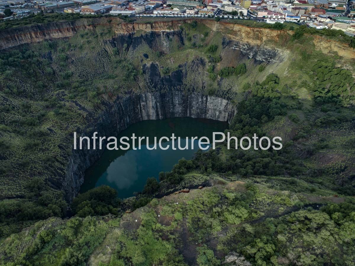
This striking aerial photograph captures The Big Hole in Kimberley, Northern Cape, one of South Africa’s most remarkable mining landscapes and one of the most recognisable physical reminders of the country’s diamond-mining history. The enormous water-filled excavation dominates the image, revealing the extraordinary scale of the Kimberley Mine and the extent to which the original landscape was transformed during the diamond rush of the late nineteenth and early twentieth centuries. Surrounded today by vegetation, roads, commercial buildings and the established urban fabric of Kimberley, the Big Hole provides an extraordinary visual connection between the city’s modern identity and the industrial activity that created it.
The Location is Kimberley, the capital of the Northern Cape Province and a city historically synonymous with South Africa’s diamond industry. The excavation lies close to the historic city centre and forms the centrepiece of the Big Hole & Kimberley Mine Museum complex. From the air, the relationship between the mine and the surrounding city is particularly clear. Urban development reaches almost to the edge of the enormous excavation, demonstrating how Kimberley grew around an industrial landscape that was once one of the most intensively worked diamond-mining areas in the world. The surrounding buildings and road network contrast dramatically with the rugged geological walls of the former mine.
The history of the site began in 1871 following the discovery of diamonds in the Kimberley area. What had been a natural hill known as Colesberg Kopje was progressively removed as thousands of diggers descended on the area during the diamond rush. The hand excavation expanded rapidly, eventually becoming the enormous crater visible in this photograph. According to the Kimberley Mine Museum, approximately 22.5 million tonnes of earth were excavated during the mine’s open-cast and associated mining operations, producing approximately 14.5 million carats of diamonds, equivalent to about 2,722 kilograms.
The scale of the excavation is difficult to appreciate from ground level. The Big Hole covers approximately 17 hectares and has a perimeter of around 1.6 kilometres, while published measurements place its depth at approximately 214–225 metres depending on how the excavation is measured. The upper portion visible in this photograph is particularly dramatic, with near-vertical exposed rock faces forming a vast amphitheatre around the dark water at the bottom. The remaining water occupies the lower section of the excavation after mining reached levels where groundwater became a major constraint.
Mining continued for more than four decades before operations at the open excavation ceased on 14 August 1914. The lower reaches eventually flooded, leaving the water-filled crater that remains one of Kimberley’s defining landmarks. Underground workings associated with the Kimberley Mine extended considerably deeper than the visible open excavation, reaching approximately 1,097 metres according to information published by the Kimberley Mine Museum.
16 MB
Reviews
There are no reviews yet.