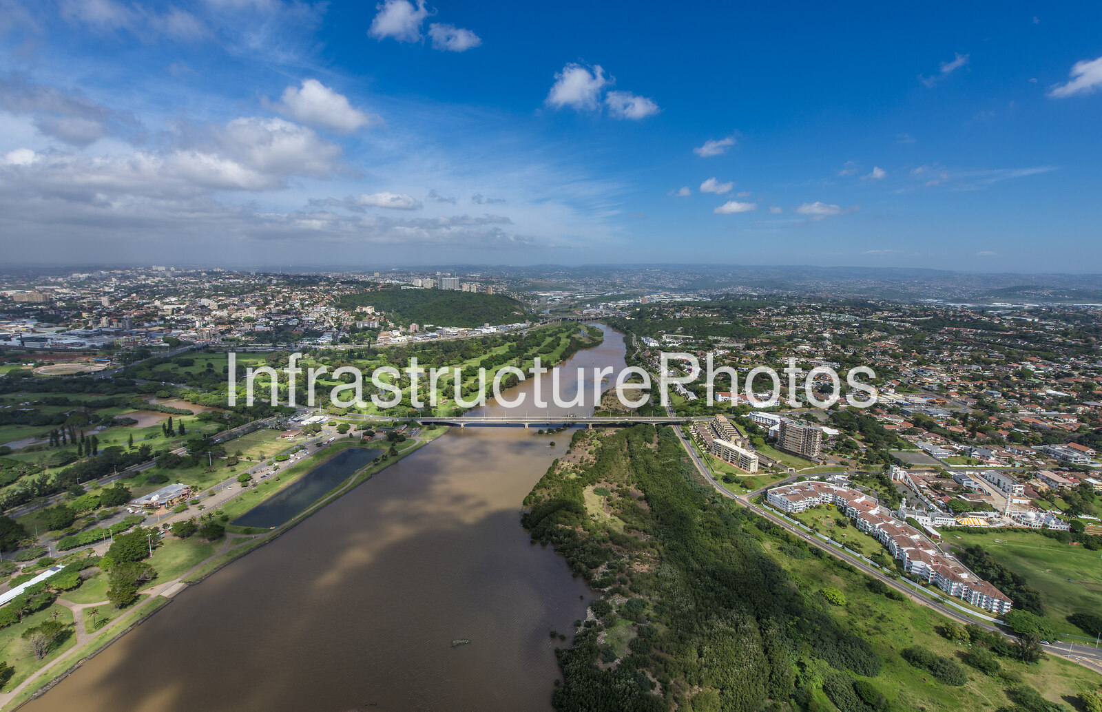
This aerial photograph captures a striking view of the uMngeni River in Durban, KwaZulu-Natal, extending inland from the Blue Lagoon area towards the northern suburbs of the city. The photograph highlights the relationship between Durban’s urban landscape, the river corridor and the extensive areas of green open space that remain along sections of the uMngeni River.
At the centre of the image, the broad brown waters of the uMngeni River wind through the urban landscape before continuing towards the Indian Ocean and the river mouth at Blue Lagoon. The river forms one of Durban’s most important natural geographical features, separating areas of the city to the south from Durban North and surrounding northern suburbs. The lower uMngeni is an estuarine environment, with Blue Lagoon and its associated Beachwood mangrove habitat forming an important recreational and ecological area.
The prominent bridge crossing the river in the photograph is Athlone Bridge, an important transport connection between Durban and Durban North. The original Athlone Bridge was constructed in the late 1920s and played a major role in the development and expansion of Durban North. The current bridge replaced the earlier structure in 1968 and continues to provide an important crossing of the uMngeni River.
The aerial perspective provides an especially clear view of the river’s relationship with the surrounding urban environment. On either side of the waterway are established residential neighbourhoods, roads, apartment developments and extensive landscaped open spaces. The contrast between the dense built environment and the green river corridor illustrates the importance of the uMngeni as a natural open-space system within metropolitan Durban.
The river corridor visible in the photograph includes substantial areas of vegetation and undeveloped land along its banks. These areas form part of the broader ecological network associated with the uMngeni estuary. The lower river has experienced extensive urbanisation and modification over many decades, including the construction of bridges, roads and development along the floodplain. Despite this transformation, significant natural and semi-natural areas remain along the river.
Looking towards the horizon, the photograph illustrates the considerable scale of Durban’s metropolitan development. Residential areas spread across the landscape, while the distant hills demonstrate the characteristic topography of the KwaZulu-Natal coastal region. The combination of river, vegetation, infrastructure and urban development makes the scene particularly representative of Durban’s distinctive relationship with its natural environment.
The uMngeni River rises in the KwaZulu-Natal Midlands and travels approximately 230 kilometres before reaching the Indian Ocean at Durban. Its lower reaches have been significantly influenced by urban development, water infrastructure and changes to the river’s natural flow regime. At its mouth, the river forms the Blue Lagoon estuarine environment, historically an important fishing and recreational destination.
Professional high-resolution infrastructure photograph available for commercial licensing. This image is suitable for editorial, architectural, construction, infrastructure, commercial, city planning, property development, urban documentation, marketing, publishing and corporate use. The downloadable file provides a high-quality version for professional applications. Buyers can use this licensed image in accordance with the store licence terms after purchase.
Original upload size: 23.29 MB
Reviews
There are no reviews yet.