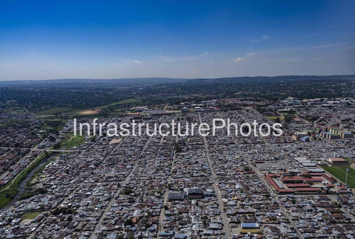
This aerial photograph presents a wide view across Alexandra, one of Johannesburg’s most historically significant townships, showing the extraordinary density and complexity of the urban landscape. From above, thousands of closely packed homes and informal structures extend across the foreground and middle distance, intersected by a network of roads, commercial buildings, community facilities and open spaces. The Jukskei River and its associated green corridors can be seen toward the left of the image, while larger formal developments and the established northern Johannesburg suburbs occupy the landscape beyond. The photograph provides a powerful visual record of the relationship between urban density, infrastructure, housing, transport and the surrounding environment.
Alexandra, commonly known as Alex, was established in 1912 on land that had previously been farmland. The settlement was created by Herbert Papenfus, who initially attempted to develop the area for white buyers. After this proved unsuccessful, the land was subdivided and made available to African and Coloured purchasers, with Alexandra subsequently becoming one of the few urban areas where Black South Africans could own property under freehold title during the early decades of the twentieth century. By 1916, the population had grown substantially, and the township developed into a densely occupied urban settlement.
The history of Alexandra is particularly significant because its development predates many of the surrounding northern Johannesburg suburbs. Today, it sits immediately adjacent to some of the city’s wealthiest areas, including Sandton, creating one of Johannesburg’s most striking contrasts in urban form and socioeconomic geography. From the air, this relationship becomes particularly apparent. The densely occupied township occupies the central portion of the image, while the greener and more spacious residential landscapes of northern Johannesburg stretch across the hills in the background.
The settlement’s distinctive urban density is one of the most immediately visible characteristics of the photograph. Buildings appear tightly arranged with relatively little undeveloped land between them. A mixture of formal houses, extensions, informal structures, commercial premises and community buildings has produced a highly complex urban fabric. Streets run through the settlement in a combination of regular and irregular patterns, reflecting both planned elements and decades of incremental development.
The Jukskei River is another defining feature of Alexandra’s landscape. The river runs through the township and has historically played an important role in shaping its development. Its flood-prone banks became heavily occupied over many decades, creating significant environmental and public-health challenges. The Alexandra Renewal Project subsequently included programmes to move households away from vulnerable river-bank areas, improve environmental conditions and create parks and open spaces along the river corridor.
30 MB
Reviews
There are no reviews yet.